|


|
The map has been created by the conversion of freely available navigational charts IENC (Inland Electronic Navigational Charts) in the format S-57 (sources are on the page Links).
As the map has been created from freely available sources it is also free - see page Download.
You can find another useful information on the page Documents
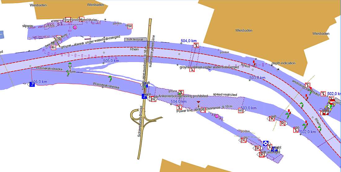
The picture below shows an extract of the river Rhein in Germany.
Details which you can see (either on computer/tablet or Garmin receiver) depend on
the size of area you want to see - the details are suppressed from the certain size because the map would become illegible.
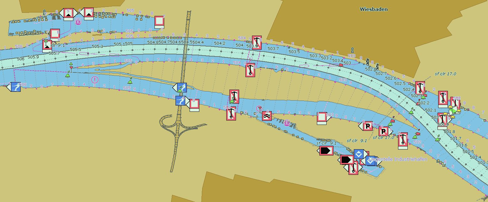
In the next picture you can see the same area, as it is shown in the ENC viewer with the original IENC.
SeeMyEnc:
|
|
 Czech
Czech