Map for Lowrance receiver
My website is about maps for Garmin receiver. Some people have asked me to make "Waterways" for Lowrance receiver.
So, I have done it with a free software Insight Map Creator.
This software produces file in AT5 (Atlas Type 5), which can be used with Navico Multifunction Displays such as Lowrance HDS, Elite, Mark, SIMRAD (NSE, NSS, NSO) and B&G Zeus.
The units map option 'Lowrance' has to be set in order to display AT5 maps. Make sure the map option is not set to 'Navionics'. Refer to the operation manual for further details.
You can download the file waterways_at5.zip. After downloading extract the file waterways.at5 and copy it on SD Card your receiver.
Although AT5 vector files can be placed anywhere on an SD card you may use: SD:\Navico\Vector\.
Please, give me a feedback, if the map is usable and/or useful for you.
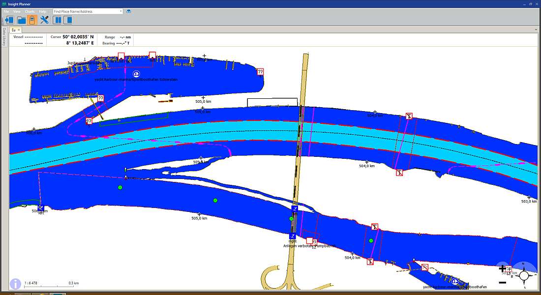
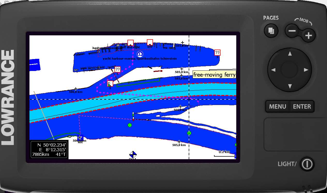
I don't have any Lowrance receiver, so I tested the map only in software Insight Planner
and on an emulator of Elite 7 HDI. You can see the result in the pictures below. It is the same area as in the picture from Homeport.
|  Czech
Czech
